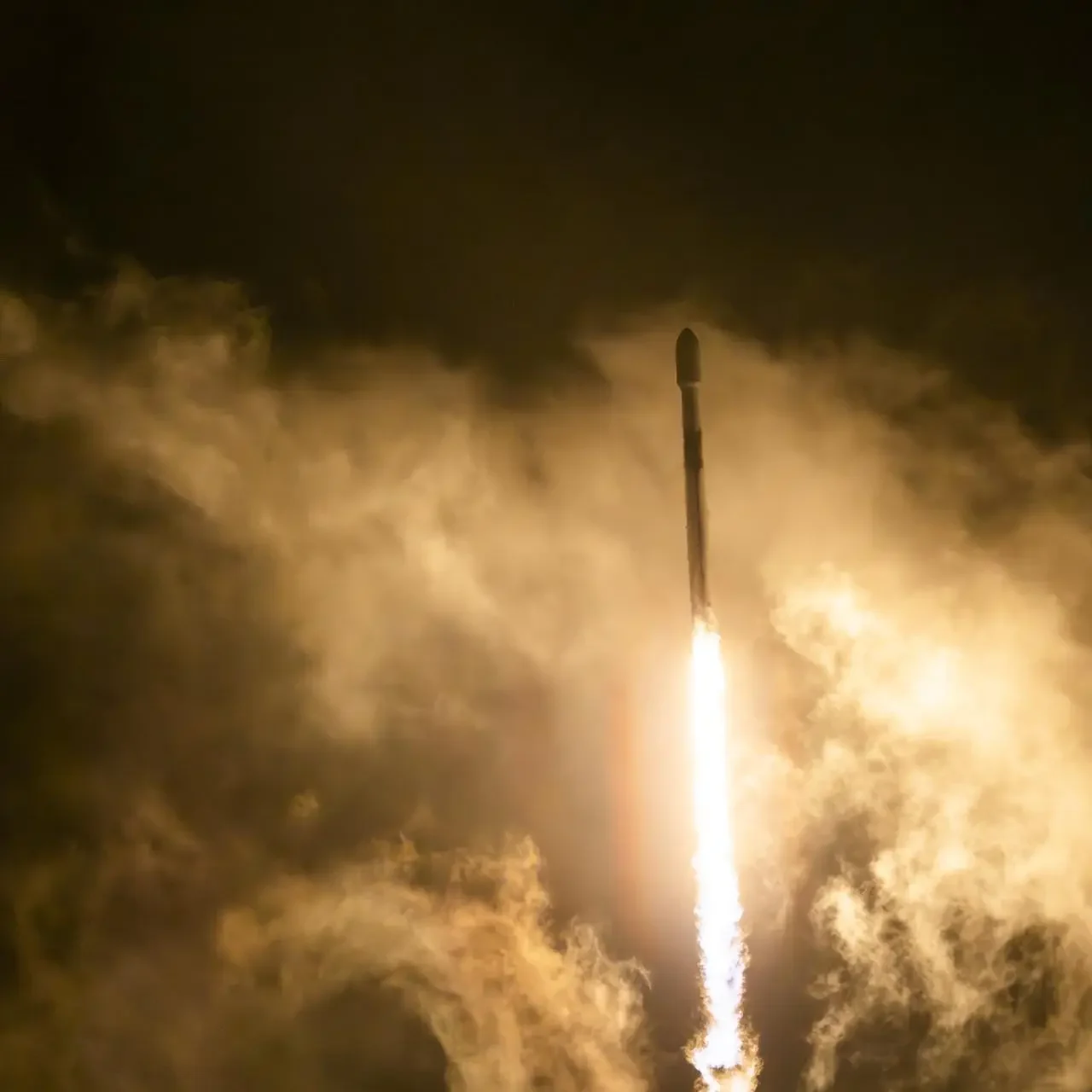
NASA, along with its U.S. and European partners, successfully launched the Sentinel-6B satellite aboard a SpaceX Falcon 9 rocket from Launch Complex 4 East at Vandenberg Space Force Base in California. The mission lifted off at 9:21 p.m. PST on Nov. 16, and the satellite checked in with a ground station in northern Canada about an hour and a half later, confirming that all systems were healthy and running smoothly.
Roughly the size of a full-size pickup truck, Sentinel-6B begins its journey to join its predecessor, Sentinel-6 Michael Freilich, in orbit. Together, these two satellites form the core of the Copernicus Sentinel-6/Jason-CS mission — a long-running international effort to track sea level rise and understand how Earth’s oceans are changing.
NASA’s Science Mission Directorate head Nicky Fox highlighted how precise ocean data directly supports life and activity on Earth. She pointed out that accurate tidal and sea level measurements help protect coastal communities, guide businesses, and even support safer splashdowns for astronauts returning from missions like Artemis. Sentinel-6B will extend the legacy of Sentinel-6 Michael Freilich, which launched in 2020 and became the gold-standard reference for global sea level measurements.
Sea levels shift from region to region, and Sentinel-6B will measure them down to fractions of an inch. These readings feed directly into U.S. flood prediction systems used to safeguard coastal infrastructure, energy facilities, shipping routes, and communities facing rising seas and stronger storms. Once Sentinel-6B reaches its operational altitude, it will trail Sentinel-6 Michael Freilich by about 30 seconds so the two can cross-calibrate their measurements. After that, the older satellite will move to a new orbit while Sentinel-6B becomes the official reference satellite.
Simonetta Cheli, who leads Earth Observation Programmes at the European Space Agency, applauded the tight collaboration behind the mission. She emphasized how long-term cooperation between agencies like ESA, NASA, EUMETSAT, NOAA, and France’s CNES continues to deliver reliable, high-precision data essential for tracking climate change, protecting oceans, and informing national and global planning.
Sentinel-6B’s data will help scientists observe nearly 90% of Earth’s oceans. Its radar altimeter will keep a close eye on sea surface height, ocean currents, and changes in temperature — all crucial for tracking the heat stored in the seas and predicting the behavior of storms and hurricanes. Since warm water fuels hurricane intensification, understanding where the ocean is heating up can make a major difference in forecast accuracy.
In addition to sea level measurements, the satellite will collect information on wind speeds, wave heights, atmospheric temperature, and humidity. These details play a direct role in marine weather forecasts, shipping safety, search-and-rescue planning, and monitoring hazards like rough seas along strong currents — such as the Gulf Stream.
NASA’s Earth Science Division director Karen St. Germain explained how this mission turns advanced space technology into everyday benefits for communities, emergency responders, and industries. The near-real-time data gathered by Sentinel-6B will flow into weather and ocean models that help protect coastal bases, ports, fisheries, military installations, and millions of people living near the shore.
The mission also serves NASA’s broader goals beyond Earth. Sentinel-6/Jason-CS data helps refine atmospheric models used for spacecraft reentry, including for astronauts returning from lunar missions. These insights even support better scientific understanding of how Earth and the Moon influence each other through ocean tides.
Dave Gallagher of NASA’s Jet Propulsion Laboratory noted that Sentinel-6B’s instruments can detect sea level changes with remarkable precision, continuing a dataset that has grown since the early 1990s. JPL also contributed three major science instruments to each satellite, including an advanced microwave radiometer and a GNSS-Radio Occultation system.
By working together, NASA, ESA, EUMETSAT, NOAA, CNES, and the European Commission have created one of the most important long-term Earth-monitoring missions ever flown. Sentinel-6B now extends that effort, strengthening the world’s understanding of rising seas, sharpening hurricane prediction, and giving coastal communities a vital tool to prepare for the future.

Siddharth is a Kochi-based mechanical engineer with a lifelong fascination for cars. His weekend passion involves analyzing new engines, driving technologies, and India’s growing electric car market. He brings technical depth with everyday readability.